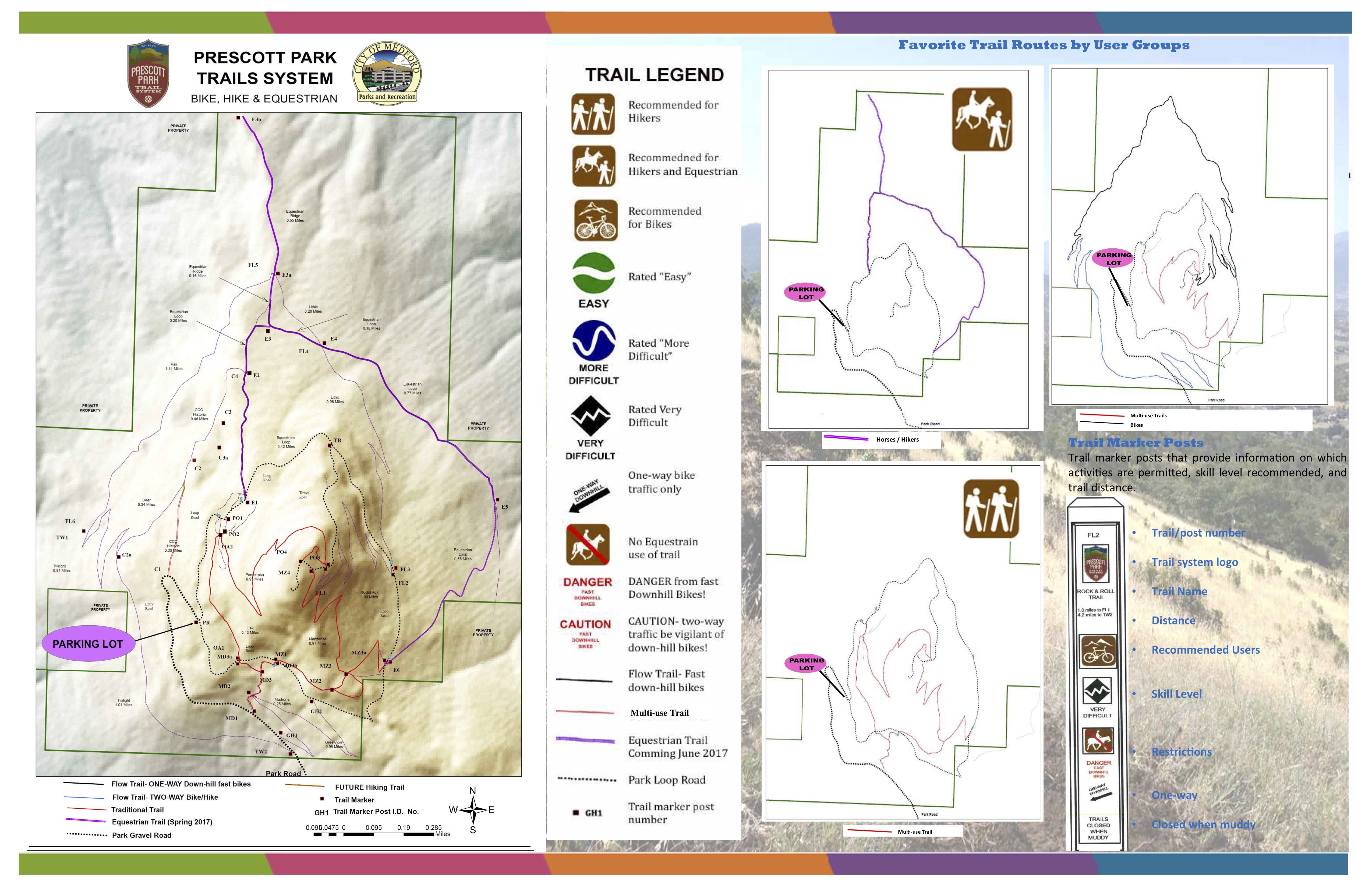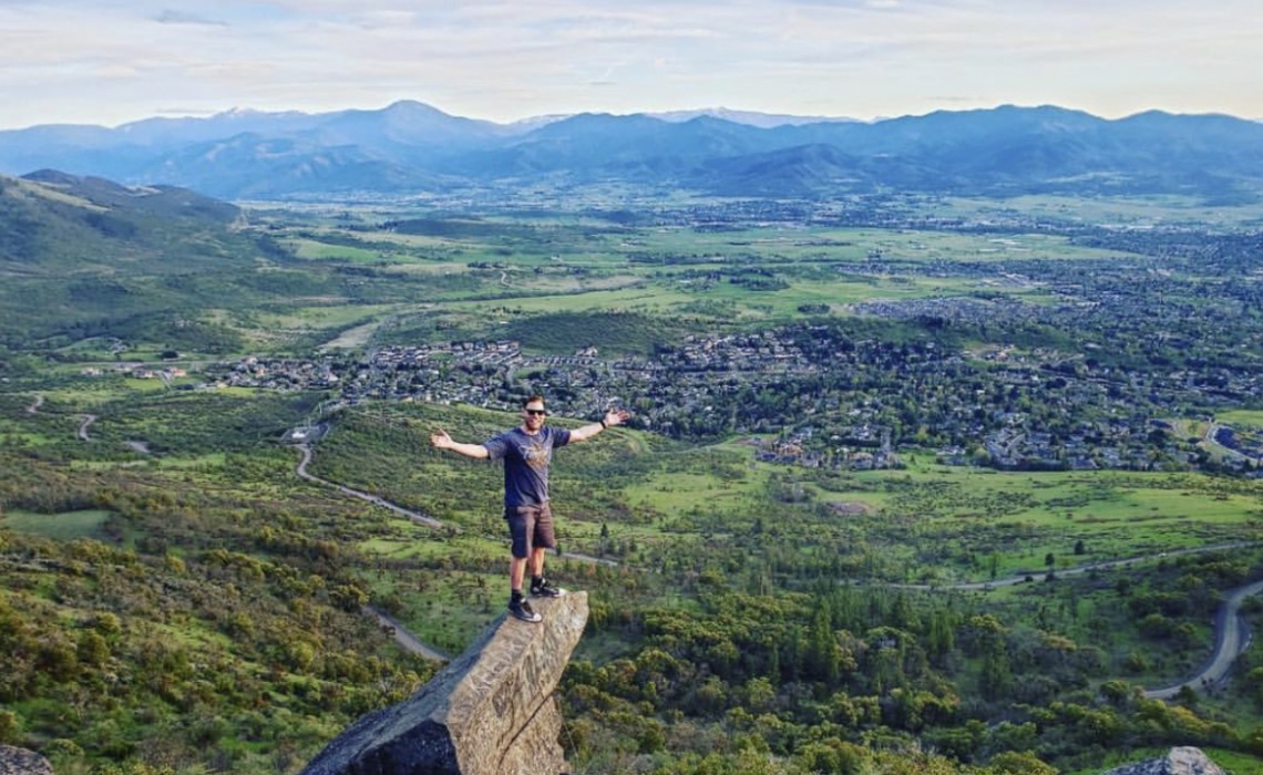


Prescott Park is 1,740 acres of hiking and mountain biking trails, both paved and unpaved, with unparalleled views of the Rogue Valley. Roxyann Peak is the crown jewel of this park with it's peak offering stunning vistas of not only the Rogue Valley but as far as Mount Shasta.
Local Tip: If the bottom gate is locked to vehicles you can still walk/hike into the park.
About the Park
Acquired by the City of Medford in 1930-31, the 1,700-acre park is the second largest municipal park holding in the State of Oregon. The primary geographical feature is Roxy Ann Peak, a landmark protruding 3,571 feet above sea level – about 2,000 feet above the valley floor. With incredible vistas, Prescott Park is a popular destination for hikers and mountain bikers. One of the most spectacular aspects of the Prescott Park Trail System is a 360-degree panorama of the Rogue Valley and surrounding mountains. Mt. Shasta can be seen looking south from the top of Roxy Ann Peak, with Mt. Ashland, the city of Medford, Table Rocks, the Three Sisters, Mt. Mcloughlin visible as one rotates clockwise.
Pre-History
Prescott Park is located adjacent to the Medford Urban Growth Boundary and is also known as Roxy Ann Peak. The peak, with an elevation of 3,571, is a readily identifiable geographic feature that stands over 2000 feet above the valley floor.
Archaeologists estimate that human beings have inhabited the upper Rogue River drainage for the past 8,000 - 10,000 years, shortly after the last Ice Age. Very little physical evidence of prehistoric inhabitants were found on Roxy Ann Peak. Although the lower Bear Creek Valley, Agate Desert area served as home to the Upland Takelma, or “Latagawa” Indians, their presence was seasonal and their impact light. A small scatter of jasper and agate waste flakes from the making of various stone tools was found at the park. The earliest explorers to see Roxy Ann Peak most likely would have been Peter Ogden and his party of Hudson Bay Company Trappers who passed it while traveling north along Bear Creek on Saint Valentines Day in 1827. Their route closely paralleled I-5.
Roxy Ann Peak
Roxy Ann Peak is a 3,576-foot-tall mountain in the Western Cascade Range at the eastern edge of Medford, Oregon. Composed of several geologic layers, the majority of the peak is of volcanic origin and dates to the early Oligocene epoch. It is primarily covered by oak savanna and open grassland on its lower slopes, and mixed coniferous forest on its upper slopes and summit, although not all the way. Despite the peak's relatively small topographic prominence of 753 feet, it rises 2,200 feet above Medford and is visible from most of the Rogue Valley. The mountain is Medford's most important viewshed, open space reserve, and recreational resource.

Option 1: Take the north I-5 exit (exit 30) and head north towards Crater Lake National Park on Hwy 62. At the second signal (about 1 mile from I-5) turn right on Delta Waters Road. Roxy Ann Peak is straight ahead at this point. Stay on Delta Waters until it ends (about 1.8 miles) at Foothill Rd and turn right. Go 1.3 miles to East McAndrews Road, go under the bridge and turn right on the clover leaf to go east on McAndrews.
Option 2: Take the south I-5 exit (exit 27) and head east on Barnett Road. Stay on Barnett, pass the Rogue Valley Hospital, and at the signal at the intersection with Foothill Road, turn left (about 2.0 miles from I-5). Go 2 miles to East McAndrews Road, turn left before the bridge onto the clover leaf that will take you east on McAndrews Road.
Once you are on East McAndrews Rd heading east towards Roxy Ann Peak, go 1.6 miles to where McAndrews ends and Hillcrest continues up the hill. Go another 1 mile and turn left on Roxy Ann Road.

Click to view a Prescott Park printable brochure that offers more information about the site and trail system.